High-Precision Positioning for Cyclists
Modern assistance systems such as traffic light phase assistant, collision warnings or the digital railway crossing enhance safety, comfort, and efficiency in road traffic. For these systems to function reliably for both vulnerable road users (VRUs) and cars, lane-level positioning is crucial – for instance, to determine the correct traffic light phase or to detect potential collisions early.
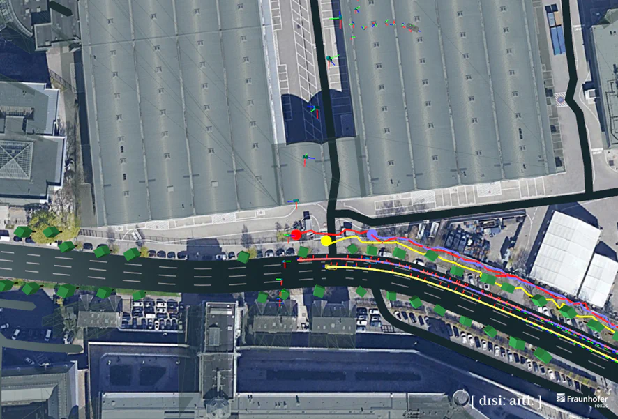
Conventional GPS often shows deviations of five meters or more. With Location-as-a-Service (LaaS), Fraunhofer FOKUS has developed a mobile edge cloud service that significantly improves positioning accuracy.
Usable on Any Smartphone
The LaaS client library processes smartphone GPS and sensor data in a privacy-compliant manner, pseudonymizes it, and sends it to the backend for optimization. There, applications can directly access the improved data.
LaaS can be used by cyclists, e-scooter riders, or car drivers. The library can be flexibly integrated into smartphone apps or driver assistance systems. By combining sensor data from multiple users with HD maps, LaaS enables precise, lane-level localization for every road user.