DiKAS
Digital control of work sites on roads
Current Situation
The state of Berlin has a highly accurate digital map of the road space. However, since the underlying survey data is only updated at larger intervals, changes in the road space cannot always be captured in a timely manner. There is a particular need for current and continuously available information regarding construction sites, traffic signs, and traffic facilities. A comprehensive digital recording of such changes does not yet exist.
Project Goal
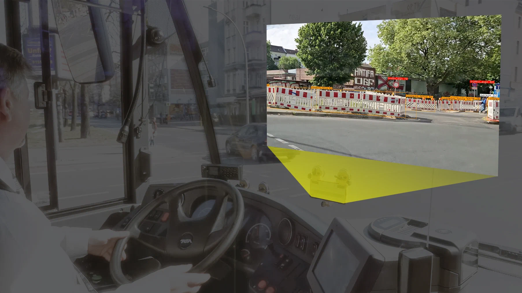
The research and development project DiKAS (Digital Control of Work Sites on Roads) develops and tests an automated solution for the continuous digitization of the road space. The basis is a smartphone application developed by Fraunhofer FOKUS that can capture road spatial data during regular trips. In the context of a pilot operation with a larger vehicle fleet, the technology is to be further developed and tested under real conditions. The goal is to automatically detect construction sites, traffic signs, and traffic facilities and to update digital road maps in near real-time.
Research Focus
The project focuses on:
- improving the automated detection of construction sites and traffic facilities,
- developing a fully automated and permanently operable recording process,
- digitally reconciling recorded construction sites with existing permits and orders.
This allows for the early detection of unauthorized construction sites, expired measures, and so-called “sleeping construction sites.”
Benefits for Berlin
DiKAS creates a more current data basis for administration and traffic management. The information obtained can help:
- improve construction site monitoring,
- make administrative processes more efficient,
- support the enforcement of regulations,
- reduce the number of “sleeping construction sites,” and
- increase traffic safety.
Advantages of the Solution
The smartphone-based data collection offers significant advantages over traditional surveying methods:
- no additional hardware required,
- data protection-compliant data collection,
- easy scaling to large vehicle fleets,
- continuous recording of large urban areas during ongoing operations.
The results of the pilot operation form the basis for the evaluation and possible later introduction of the technology in regular operations.
Data Protection
The smartphones mounted in the BVG vehicles are equipped by Fraunhofer with an app that films road traffic. The app detects street furniture and other traffic-relevant objects (e.g., signs, traffic lights, directional arrows, lane markings, curbs, and parking spaces). Very short-term images are held exclusively in the RAM of the mobile device and are immediately discarded from the RAM after processing. No images of individuals or license plates and no audio recordings are permanently stored or evaluated.